Where Malur Sits, and Where Godrej Plots Malur Is Said to Be
Before anything else, the fact that governs this whole site: Godrej Properties has not announced a plotted development at Malur, and no such project is registered with the Karnataka Real Estate Regulatory Authority. K-RERA carries no registration of any class for a Godrej project anywhere in Kolar district, and Malur does not appear in Godrej Properties' own project catalogue or in its published list of operating cities. What exists is campaign material circulating on unaffiliated marketing domains under the name "Godrej Plots Malur". Everything on this page that concerns that campaign is attributed to it. Everything about Malur itself is drawn from primary records and is stated plainly.
A second, equally important caveat: there is no site pin. No parcel, survey number or address has been published for the circulating scheme, so there is nothing to measure from. Every distance on this page is measured from the Malur town centroid (13.0059, 77.9394) by road, using the OpenStreetMap driving network. These are town-to-destination figures, not project-to-destination figures, and they should be read that way.
| Field | Detail |
|---|---|
| Administrative location | Malur town, Malur taluk, Kolar district, Karnataka |
| PIN (Malur town / Kasaba hobli) | 563130 |
| Population | ~40,000 (2011 census) |
| K-RERA taluk code | 1265/347 |
| Reference coordinates used on this site | 13.0059, 77.9394 (town centroid) |
The circulating campaign names "Malur" and nothing more precise. No survey number, no village, no hobli and no street address appears anywhere in the material, so there is no way to place the supposed parcel inside the taluk — which is why this page anchors on the town itself and measures from it.
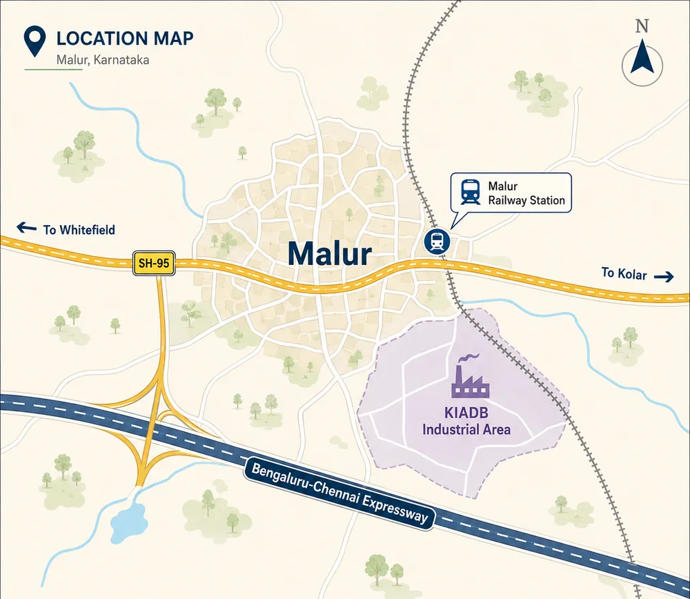
Malur is a taluk headquarters, not a Bengaluru suburb. It has its own municipal town core, its own railway station, its own weekly market and a substantial industrial estate on its western edge. Bengaluru's built-up edge stops well short of it. That distinction matters, because a great deal of listing copy for this belt is written as though Malur were an outer neighbourhood of the city, and it is not.
Three Things the Godrej Plots Malur Listing Copy Gets Wrong
These are worth correcting up front, because they appear across the marketing material for this project and across the wider Malur belt.
- Malur is not on NH-75. NH-75 runs Mangaluru–Hassan–Bengaluru–Kolar–Mulbagal–Katpadi and does not pass through Malur. The nearest point on NH-75 is roughly 13.9 km by road north of the town. Malur's own highway is SH-95, signposted "Malur–Hosur Road".
- Kolar town is 36.72 km away by road, not "about 20 km". The district headquarters is a substantially longer trip than the listing copy implies, and treating it as a neighbouring suburb misreads the geography.
- Malur is not in BMRDA jurisdiction. The Bangalore Metropolitan Region covers three districts and Kolar is not one of them. "BMRDA approved" appears constantly in plotted-layout copy across this belt; for Malur it is simply incorrect, and approvals here run through Kolar district channels rather than through BDA or BMRDA.
Two Markets Are Sold as "Malur", and the Godrej Plots Malur Campaign Does Not Say Which
This is the single most useful thing a buyer can understand about the micro-market, and almost no listing page explains it.
| Sub-market | Where | Broker asking band |
|---|---|---|
| Malur town proper | Kasaba hobli, PIN 563130 | ~Rs 3,250–5,000 per sq ft |
| Chikkathirupathi / Lakkur hobli corner | PIN 563160 / 563163, marketed as "Sarjapur Road" | ~Rs 6,000–8,000 per sq ft |
The Lakkur corner sits in Kolar district on paper but functions as an east-Bengaluru location: it is far closer to Sarjapur and Whitefield than it is to Malur town, and it is marketed accordingly, usually without the word "Malur" appearing at all. Malur town proper is a different place with a different price base and a different demand driver.
Those two bands are broker asking prices, not transacted prices, and they should be treated as soft. Aggregator rate pages for Malur contradict each other by roughly threefold, and there is no accessible registered-transaction series or retrievable guidance value for the taluk. The circulating Godrej campaign says "Malur" without qualifying which sub-market it means; because it names Malur, this site reads it as Malur town proper and says so.
Road and Highway Access for Anyone Assessing Godrej Plots Malur
Malur's road position changed materially and recently, and this is the strongest genuine part of its case.
- The Bengaluru–Chennai Expressway opened on 9 December 2024. This is a dated, verifiable event, not a proposal.
- The STRR (NH-648) now passes within a couple of kilometres of the town, giving Malur a link onto the ring corridor that connects Hosur, Dobbaspet, Devanahalli and Hoskote without entering Bengaluru.
- SH-95 (Malur–Hosur Road) is the town's own state highway and its primary north–south spine.
- NH-75 is reachable roughly 13.9 km by road to the north.
For travel time, this site publishes no drive-time number of its own. The most defensible statement available comes from Brigade Group's own Malur property guide, which describes Malur as approximately 45 km east of Bengaluru with a travel time of roughly 1 to 1.5 hours by road, and puts Whitefield at about 26 km from Malur. That is a developer's published figure for its own registered project in this taluk, and it is quoted here as such.
| Destination | Routed road distance from Malur town |
|---|---|
| Malur Industrial Area (KIADB) | 4.89 km |
| Kolar town | 36.72 km |
| Bengaluru Cantonment railway station | 44.81 km |
| Infosys Gate 1, Electronic City Phase 1 | 45.23 km |
| Majestic interchange, central Bengaluru | 47.88 km |
| Kempegowda International Airport | 52.44 km |
Rail Access, and Why It Matters More Here Than in Most Corridors
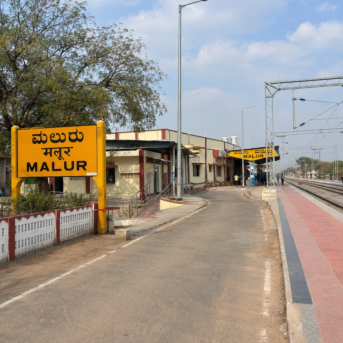
Malur has a working railway station on the Bengaluru–Jolarpettai line, 2.34 km by road from the town centre. For a taluk town of this size that is unusual, and it is the reason Malur has an industrial base at all — the line predates the industrial estate and shaped it.
| Station | Routed road distance from Malur town |
|---|---|
| Malur | 2.34 km |
| Byatrayanahalli | 10.44 km |
| Tyakal | 17.97 km |
| Devangonthi | 20.05 km |
| Whitefield | 30.32 km |
| Kolar | 36.67 km |
| Bengaluru Cantonment | 44.81 km |
The Bengaluru–Jolarpettai corridor carries suburban and passenger services toward KSR Bengaluru City and Bengaluru Cantonment. For anyone assessing Malur, the rail line is a more honest connectivity asset than the road, because it is not exposed to Bengaluru's peak-hour congestion in the way the highway approach is.
Metro Access From Malur, and a Godrej Plots Malur Claim That Does Not Hold
There is no metro at Malur, and none of the operational Namma Metro network reaches Kolar district.
| Station | Line | Routed road distance from Malur town |
|---|---|---|
| Whitefield (Kadugodi) | Purple | 30.70 km |
The circulating Godrej Plots Malur material quotes a metro distance far shorter than that, and it does not survive checking — the station it names is on the opposite side of Bengaluru from Malur, so the figure attached to it cannot be a road distance to anything. We have not reproduced it. The nearest station on the operational network is Whitefield (Kadugodi) at 30.70 km by road from Malur town, and any figure materially shorter is measuring something other than a drive to a metro station. Treat metro proximity as a non-factor in a Malur purchase.
Air Connectivity From Malur Town
Kempegowda International Airport is 52.44 km by road from Malur town. This is the run where map-based measurement misleads most sharply — a straight-line measurement understates the airport drive by nearly 60%, because the route has to work around the eastern edge of Bengaluru rather than cutting across it. Listing copy that quotes map distances for Malur will always read shorter than the drive actually is.
Employment: What Actually Drives Malur
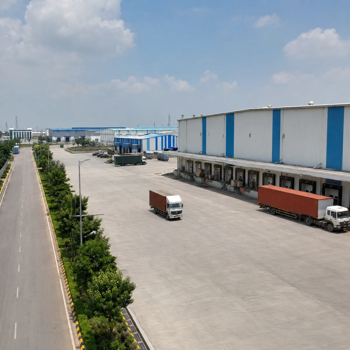
Malur's demand base is industrial, not residential. Roughly 1,600 to 2,600 acres of KIADB industrial land sits in Malur taluk, and the Malur Industrial Area is 4.89 km by road from the town centre. The taluk's search demand reflects this — enquiries about Malur are dominated by questions about its industrial area and the companies operating there, not by residential terms.
| Employment node | Routed road distance from Malur town |
|---|---|
| Malur Industrial Area (KIADB) | 4.89 km |
| Whitefield railway station (east Bengaluru IT belt) | 30.32 km |
| Whitefield (Kadugodi) metro | 30.70 km |
| Kolar town (district headquarters, government and services) | 36.72 km |
| Infosys Gate 1, Electronic City Phase 1 | 45.23 km |
| Central Bengaluru (Majestic interchange) | 47.88 km |
Brigade's published guide puts Whitefield at about 26 km from Malur, close to the 30.32 km our routed figure gives for Whitefield railway station; the difference is the usual gap between a corridor-level description and a specific measured endpoint.
The practical reading: Malur works for a household with a job in the KIADB estate, in Kolar, or in a role that does not require a daily Bengaluru commute. It does not work as a daily-commute base for the east Bengaluru IT belt, and no honest reading of these distances makes it one.
Schools and Education Around Malur
Malur is a taluk town, and its education provision has taluk-town depth: state-board and local private schools serving the town and surrounding villages, plus a government junior college and a JSS campus within walking or short-driving distance of the town centre. It does not have the density of international and large private-board campuses found on Bengaluru's eastern and northern corridors.
| Institution | Type | Routed road distance from Malur town |
|---|---|---|
| Government Junior College, Malur | Pre-university | 0.81 km |
| JSS Mahavidyapeetha campus | Education campus | 1.29 km |
⚠️ This table is short for a reason a buyer should know about. The public mapping data for Malur is thin — the OpenStreetMap database carries no mapped school records for the town at all, which is a gap in the map, not a statement that Malur has no schools. It plainly does. What we will not do is publish a list of institution names and distances we cannot verify against a primary record. Anyone shortlisting a plot here should treat schooling as a ground-check item: visit, confirm boards and admission cycles, and time the actual school run rather than relying on any published table, this one included.
Hospitals and Medical Care Near Malur Town
| Facility | Routed road distance from Malur town |
|---|---|
| Malur Government Hospital | 0.48 km |
| Sanjana Hospital | 0.53 km |
| Bharani Hospital | 2.47 km |
| Jadigenahalli Hospital | 10.88 km |
The same mapping caveat applies: these are the facilities carried in the public map record, and the list is certainly not exhaustive of what operates in the taluk. What the record does support is a fair characterisation of the level of care available. Malur town has a government hospital and local private hospitals and nursing homes within a kilometre or two of the centre — adequate for routine and emergency-stabilisation needs. Tertiary and specialist care is not in Malur. It is in Kolar town (36.72 km by road) or in east Bengaluru (Whitefield is 30.32 km). For a household with an ongoing specialist requirement, that is a real constraint and should be tested before purchase, not after.
Note also the road-versus-map divergence in this table: Bharani Hospital is roughly twice as far by road as it looks on a map. In a town with an irregular road grid, map distances systematically flatter the drive.
Retail and Everyday Social Infrastructure at Malur
Malur's retail is high-street and market-format: the town centre, the weekly market, standalone grocery and hardware trade serving both the town and the industrial estate. The public map record carries no mall-format retail in Malur, and on this one the map and reality broadly agree — large-format organised retail has not arrived in the town. Households here reference the east Bengaluru retail cluster for mall-scale shopping, which the routed table puts around 30 km away, and Kolar town at 36.72 km for district-level services.
This is normal for a taluk town of about 40,000 people with a large industrial estate attached. It is only a problem if the buyer has been sold something else.
Groundwater: The Most Material Location Fact for Any Malur Plot
Karnataka's own State Expert Appraisal Committee has on record that Malur is a groundwater over-exploited area, with actual borewell depth exceeding 1,000 feet.
This belongs near the top of any Malur plot buyer's checklist, and it is materially more important for a plotted purchase than it would be for an apartment. In an apartment the developer contracts the water arrangement, sizes the sump and the treatment plant, and carries the recurring obligation. On a plot, the buyer builds the house and the water problem becomes the buyer's own — and a 1,000-foot borewell is expensive to sink, uncertain in yield and offers no guarantee of a stable supply over a twenty-year ownership horizon.
Before committing to any plot in this taluk, establish in writing:
- The assured water source for the layout — borewell, piped municipal supply, tanker dependence, or a combination, and who is contractually responsible for it.
- The layout-level supply arrangement — whether there is a common sump, distribution mains and metered connections to each plot, or whether each buyer is expected to sink an individual borewell.
- Measured borewell yield at the parcel, with the depth at which water was struck, rather than a verbal assurance.
- What happens in a dry year, and who bears the cost of tanker supply.
None of this is a reason to rule Malur out. It is a reason to price it correctly and to ask the question before signing rather than after.
The Documented Plotted Market Around Godrej Plots Malur
This is where the contrast on this site becomes sharp. Malur is not an unregulated frontier where nobody files paperwork — Malur taluk carries 91 K-RERA-registered projects, and Kolar district carries more than 180. Branded developers are active here and they register. Which is exactly why the absence of any Godrej registration in the district is worth stating plainly rather than glossing over.
The clearest local benchmark is Brigade Cherry Blossom, a plotted layout at Madanahatti Venkatapura Village, Kasaba Hobli, Malur Taluk, PIN 563130, registered as PRM/KA/RERA/1265/347/PR/010825/007969 and held by Mysore Projects Private Limited, a Brigade Group entity. It was approved on 01-08-2025 with a proposed completion date of 31-03-2028.
One detail on that record is instructive for anyone reading RERA numbers in listing copy: Brigade Enterprises Limited appears on it only as the registered agent, under PRM/KA/RERA/1251/309/AG/170829/000440. That is an /AG/ agent-class registration — a broker registration — and it is not a project registration for anything. A number in a listing is not automatically proof that a project is registered; the class letters in the middle of the number tell you what it actually is.
Other K-RERA-registered projects in Malur taluk, verified from signed certificates:
| Project | Registered holder | Location and approval |
|---|---|---|
| Concorde Equity Phase II | Concorde Housing Corporation Pvt Ltd | Sy. 135/3 & 135/5, Maliyappanahalli Village, Kasaba Hobli — approved 16-12-2025 |
| Geown Casper Tranquil | Geown Casper Estates LLP | Maliyappanahalli Village — approved 05-12-2025 |
| Shriram Chirping Ridge | Meru Pravat Structure Pvt Ltd | 21 ac 33 g, Sampangere Village, Lakkur Hobli — approved 12-01-2023 |
| Chirping Ridge Phase 2 | Meru Pravat Structure Pvt Ltd | 3 ac 20 g — approved 29-11-2025 |
| Riqueza Laughing Earth Phase II | Riqueza Estates Pvt Ltd | Yarappanahalli Village — approved 23-07-2025 |
| ARE Reserve | ARE Realty | Sy. 41, Kanivenahalli Village — approved 02-06-2026 |
| Infinity East Bay Gardens | Infinity Infra | approved 27-07-2026 |
| Dasara Utsav | Dasara Developers | approved 23-07-2026 |
| Bhoo Siri Garden | 19 Bhoo Ventures | approved 05-06-2026 |
A caution on branded names in this taluk: "Sobha Sacred Grove by the Lake" is registered to Iustus Residential Layout Private Limited, not to Sobha Limited, under PRM/KA/RERA/1265/347/PR/020226/008445 at Chikkathirupathi Village, Lakkur Hobli, PIN 563160, approved 02-02-2026. The Sobha branding on that project appears on channel-partner domains; any Sobha involvement is a marketed tie-up we could not verify against the registration. The same loose labelling affects a genuine Godrej project elsewhere in the belt: Godrej Woodland is marketed as "Sarjapur Road / Chikka Tirupathi" while its RERA address is Hoskote taluk in Bengaluru Rural.
Honest Trade-offs Before Acting on a Godrej Plots Malur Enquiry
This section is the point of the page. Every constraint below is real, and none of it is disqualifying on its own.
1. There is nothing to verify on the circulating scheme. Godrej Properties has not announced a Malur project, it is not registered with K-RERA, and no approved layout plan, survey number, land area, plot count or price exists in any primary record. Without a K-RERA registration there is no registered completion date, no escrow discipline on collections, and none of the buyer protections that attach to a registered project. Any payment made against an unregistered plotted scheme sits outside that framework entirely.
2. Water is the structural constraint. Groundwater over-exploitation with borewell depths beyond 1,000 feet, on a product where the buyer carries the water problem personally. See the section above.
3. This is not a Bengaluru commute address. Brigade's own guide says roughly 1 to 1.5 hours by road to Bengaluru. Whitefield is 30.32 km, Electronic City 45.23 km and central Bengaluru 47.88 km, all by road, all from the town rather than from a parcel. A household with two Bengaluru jobs should drive it at 8:30 on a weekday morning before forming a view.
4. Social infrastructure is taluk-town depth. Good enough for daily life; not equivalent to an established Bengaluru corridor for schooling choice, specialist healthcare or organised retail. Tertiary care is 30 to 37 km away.
5. The price evidence is genuinely thin. No registered-transaction series, no retrievable guidance value, no dated institutional micro-market report, and aggregator rates that contradict each other by roughly threefold. The one resale listing we could verify that carried both a price and an area — 1,200 sq ft at Rs 39.00 lakh — works out to Rs 3,250 per sq ft. One datapoint is not a market.
6. "Malur" is used loosely, and so is "BMRDA". Confirm which sub-market a listing means, and discount any claim of BMRDA approval outright.
7. Planning and approval chain is different here. Outside Bengaluru Urban and outside BMRDA, the approval trail, khata records and conversion orders run through Kolar district offices. Budget time for diligence; do not assume a Bengaluru-standard paper trail.
What the Godrej Plots Malur Micro-Market Case Rests On, Without a Forward Projection
This site publishes no return, yield or appreciation projection of any kind, for Malur or anywhere else. Marketing pages circulating for this scheme do publish such figures. They are unsubstantiated and are not reproduced here in any form, and a reader who encounters them elsewhere should treat them as a reason for caution rather than a reason for confidence.
What can be stated is what has actually changed, with dates attached:
- 9 December 2024 — the Bengaluru–Chennai Expressway opened, and the STRR (NH-648) now runs within a couple of kilometres of Malur. This is the largest single change to the town's position in decades.
- 21 April 2025 — Brigade disclosed to the exchanges (BEL/NSEBSE/PR/21042025) a plotted development at Malur of around 20 acres with "the Gross Development Value of the project is around Rs. 175 crores with a total development potential of 0.45 million square feet". K-RERA independently confirms the joint development agreement was registered on 21/04/2025 at the Malur sub-registrar's office.
- 8 August 2025 — Brigade announced the launch of Cherry Blossom (BEL/NSEBSE/PR/08082025) as "a strategic joint venture plotted development" on "20 acres and 11 guntas" with a "total development area of 4.51 lakh sqft" and "projected revenue potential exceeding Rs 225 crores".
Those two disclosed money figures moved from around Rs 175 crore to over Rs 225 crore on essentially unchanged area in under four months. They carry different labels on Brigade's own filings — one is "Gross Development Value", the other "revenue potential" — both are hedged, and both are the company's internal estimate of its own project. This is a movement in a developer's projection, not a measured movement in Malur land prices, and it must not be read as appreciation.
Two further anchors belong in a price discussion rather than a location one, but their shape matters to the corridor case. Godrej Properties disclosed a plotted average selling price of Rs 6,177 per sq ft across FY26 — a national average spanning nine projects in eight states, useful as a sense of what branded plotted product costs as a category, and emphatically not a Malur rate. And the one branded launch anchor inside Malur itself resolves to a range rather than a rate: Brigade's disclosed revenue potential across 4.51 lakh sq ft implies materially different per-sq-ft outcomes depending on whether it is read whole-project or on Brigade's own economic share, which its Q2 FY26 investor presentation puts at roughly 51 to 58 percent of the project. Either way it is a forward revenue projection to a March 2028 completion, not an achieved price and not a transacted rate.
That is the whole of the case, and it is deliberately unglamorous. Malur has a genuine, dated infrastructure improvement, a real industrial employment base, an active and registered plotted market, and a thin, low-transparency price record with a serious water constraint. It does not, on any record we can find, have a Godrej project.
Malur location FAQ
Where Malur is, which highway actually serves it, and how far the anchors really are by road.
Where exactly is Malur?
Malur is a taluk headquarters town in Kolar district, Karnataka, with PIN 563130 in Kasaba hobli and a population of roughly 40,000 at the 2011 census. Every distance published on this site is measured by road from the Malur town centroid at 13.0059, 77.9394, because there is no site pin to measure from: no parcel, survey number or address has been published for the circulating campaign. That qualification matters. A distance from a taluk town is not a distance from a plot, and on this road network the difference can run to several kilometres in either direction.
Is Malur on NH-75?
No, and this is the single most repeated error in listing copy for the belt. NH-75 runs Mangaluru to Hassan, Bengaluru, Kolar, Mulbagal and Katpadi, and it does not pass through Malur; the town sits roughly 13.9 km by road south of the nearest point on it. Malur's own highway is SH-95, signposted Malur–Hosur Road. The same copy usually places Kolar town about 20 km away, which is also wrong: Kolar is 36.72 km by road from Malur.
How far is Malur from Bengaluru?
By road from the town centre, the anchors are as follows. We publish no drive-time figure of our own, because a single minute count on a Bengaluru approach road tells a buyer nothing useful. The most defensible travel-time statement available is Brigade's, from its own Malur property guide, which describes the town as approximately 45 km east of Bengaluru with a journey of roughly one to one and a half hours by road, and puts Whitefield about 26 km away.
How far are the airport and the nearest railway station?
Kempegowda International Airport is 52.44 km by road from Malur town. Malur has its own railway station on the Bengaluru–Jolarpettai line, 2.34 km by road from the town centre, with Byatrayanahalli at 10.44 km and Devangonthi at 20.05 km. The airport run is one of the sharpest map-versus-road divergences in this corridor, which is why every figure here is routed road distance and never a straight line. We have not been able to reconcile the distance claims made on the circulating campaign pages with routed distances from Malur town, and we do not reproduce them.
What did the Bengaluru–Chennai Expressway change?
The Bengaluru–Chennai Expressway opened on 9 December 2024, and the Satellite Town Ring Road, NH-648, now passes within a couple of kilometres of Malur town. This is the single biggest genuine change to Malur's position in a decade, and unlike most of what is written about the corridor it is recent, dated and attributable. It is also the plainest explanation for why branded plotted developers have entered the taluk over the past two years. What it does not do is say anything about any particular parcel, including this one.
Ask about the Malur corridor
Every distance on this page is measured by road from the Malur town centroid, because no site pin has been published for the circulating campaign. Ask us for the routed workings.
Contact us